


ZUMA Voting District, Rock Island County, Illinois
About
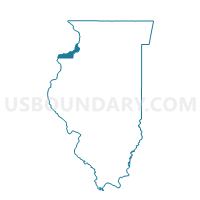
Outline

Summary
| Unique Area Identifier | 574099 |
| Name | ZUMA Voting District |
| County | Rock Island County |
| State | Illinois |
| Area (square miles) | 24.34 |
| Land Area (square miles) | 23.77 |
| Water Area (square miles) | 0.57 |
| % of Land Area | 97.66 |
| % of Water Area | 2.34 |
| Latitude of the Internal Point | 41.55465490 |
| Longtitude of the Internal Point | -90.26384800 |
Maps


Graphs
Select a template below for downloading or customizing gragh for ZUMA Voting District, Rock Island County, Illinois


Neighbors
Neighoring Voting District (by Name) Neighboring Voting District on the Map
- CANOE CREEK Voting District, Rock Island County, IL
- COE Voting District, Rock Island County, IL
- HAMPTON 1 Voting District, Rock Island County, IL
- HAMPTON 9 Voting District, Rock Island County, IL
- HANNA 1 Voting District, Henry County, IL
- HANNA 2 Voting District, Henry County, IL
- PHENIX Voting District, Henry County, IL
Top 10 Neighboring County Subdivision (by Population) Neighboring County Subdivision on the Map
- Hampton township, Rock Island County, IL (21,711)
- Hanna township, Henry County, IL (2,344)
- Phenix township, Henry County, IL (1,672)
- Coe township, Rock Island County, IL (1,657)
- Zuma township, Rock Island County, IL (757)
- Canoe Creek township, Rock Island County, IL (711)
Top 10 Neighboring Place (by Population) Neighboring Place on the Map
Top 10 Neighboring Elementary School District (by Population) Neighboring Elementary School District on the Map
Top 10 Neighboring Secondary School District (by Population) Neighboring Secondary School District on the Map
Top 10 Neighboring Unified School District (by Population) Neighboring Unified School District on the Map
- Geneseo Community Unit School District 228, IL (16,118)
- Riverdale Community Unit School District 100, IL (6,832)
Top 10 Neighboring State Legislative District Lower Chamber (by Population) Neighboring State Legislative District Lower Chamber on the Map
Top 10 Neighboring State Legislative District Upper Chamber (by Population) Neighboring State Legislative District Upper Chamber on the Map
Top 10 Neighboring 111th Congressional District (by Population) Neighboring 111th Congressional District on the Map
Top 10 Neighboring Census Tract (by Population) Neighboring Census Tract on the Map
- Census Tract 201, Rock Island County, IL (7,127)
- Census Tract 301, Henry County, IL (5,929)
- Census Tract 302.03, Henry County, IL (4,311)